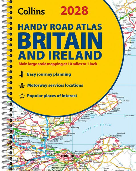
2028 HANDY RD ATL_RD ATL SP A5 Spiral
-
- Englisch ausgewählt
8,99 €
inkl. gesetzl. MwSt.,
- Kostenlose Lieferung ab 30 € Einkaufswert
- Versandkostenfrei für Bonuscard-Kund*innen
Beschreibung
Produktdetails
Einband
Taschenbuch
Erscheinungsdatum
11.03.2027
Verlag
Collins ELTSeitenzahl
80
Maße (L/B/H)
21/15,4/0,5 cm
Gewicht
270 g
Sprache
Englisch
ISBN
978-0-00-885113-2
Explore Britain with easy-to-read mapping from Collins.
This easy-to-use, handy A5 road atlas with spiral binding features extremely clear route planning maps of Britain and Ireland, and fits neatly into your glove box or bag.
The maps of Britain are at 10 miles to 1 inch (1:625,000) and the whole of Ireland is covered at 15.8 miles to 1 inch (1:1,000,000). There is also a selection of more detailed urban area maps at 4.5 miles to 1 inch (1:285,000) to aid route planning in these busy areas.
Main features:
¿ Road maps that focus on the main roads, motorways and settlements
¿ More detailed maps of London, Manchester, Merseyside and West Midlands
¿ Updated Park & Ride locations, new rail stations and extensions to tram lines in Blackpool and Edinburgh
¿ Handy distance calculator chart highlighting distances between the major towns
¿ Over 30 categories of places of interest including castles, theme parks, sports venues and surfing beaches
¿ Now includes dual Welsh / English names for Welsh locations, for example, Caerdydd / Cardiff
Noch keine Bewertungen vorhanden
Verfassen Sie die erste Bewertung zu diesem Artikel
Helfen Sie anderen Kundinnen und Kunden durch Ihre Meinung.
Kurze Frage zu unserer Seite
Vielen Dank für Ihr Feedback
Wir nutzen Ihr Feedback, um unsere Produktseiten zu verbessern. Bitte haben Sie Verständnis, dass wir Ihnen keine Rückmeldung geben können. Falls Sie Kontakt mit uns aufnehmen möchten, können Sie sich aber gerne an unseren Kund*innenservice wenden.
zum Kundenservice