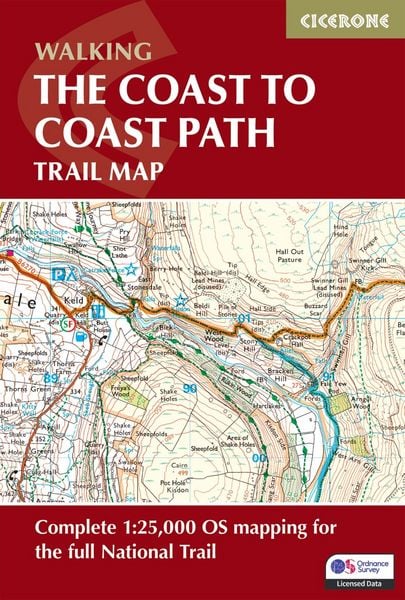
The Coast to Coast Path Trail Map Complete 1:25,000 OS Maps for the National Trail route
-
- Englisch ausgewählt
16,99 €
inkl. gesetzl. MwSt.,
- Kostenlose Lieferung ab 30 € Einkaufswert
- Versandkostenfrei für Bonuscard-Kund*innen
Beschreibung
Produktdetails
Einband
Taschenbuch
Erscheinungsdatum
18.09.2026
Abbildungen
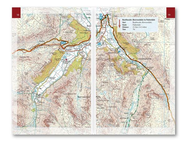
3 photographs; 93 pages of maps; 1 gradient profile
Verlag
Cicerone Press LimitedSeitenzahl
104
Maße (L/B/H)
17,2/11,6/0,7 cm
Gewicht
140 g
Auflage
2 Revised edition
Sprache
Englisch
ISBN
978-1-78631-207-5
Warnhinweis
Dieser Hinweis kann lt. Artikel 9 Absatz 7 Satz 2 der GPSR entfallen, da das Produkt auch ohne Anweisungen und Sicherheitsinformationen sicher und wie vom Hersteller vorgesehen verwendet werden kann.
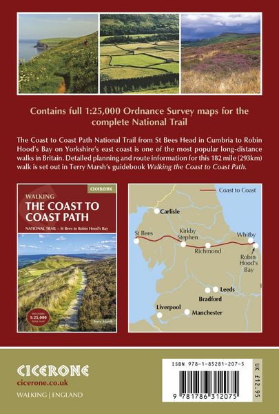
Walk one of the UK’s most iconic long-distance trails on the Coast to Coast Path National Trail, crossing northern England from St Bees on the Irish Sea to Robin Hood’s Bay on the North Sea. Covering 182 miles (293km), this classic route links three of England’s finest national parks – the Lake District, Yorkshire Dales and North York Moors – offering a spectacular journey through mountains, valleys, moorland and historic countryside.
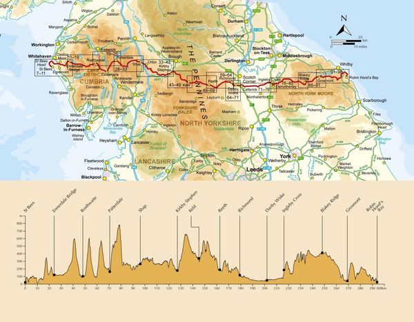
The Coast to Coast Path is widely regarded as one of Britain’s best long-distance walks. Avoiding towns wherever possible and favouring high ground, the trail reveals the changing landscapes, geology and cultural history of northern England. Beginning with a dramatic clifftop walk at St Bees Head, the route soon heads inland into the western Lake District, exploring remote valleys and high passes beneath famous fells before leaving Lakeland by the shores of Haweswater. Beyond the Lake District, the route crosses the limestone uplands around Shap and enters the Yorkshire Dales, where historic mining landscapes and sweeping moorland lead to the high crossing of Nine Standards Rigg. The trail then continues through Swaledale and Richmond before traversing the quiet farmland of the Vale of Mowbray. The final section crosses the wide open heather moorland of the North York Moors and finishes with a memorable clifftop walk down to the North Sea at Robin Hood’s Bay.
- 1:25,000 OS trail map with Ordnance Survey Explorer map legend
- Shows the full 182-mile (293km) route of the Coast to Coast Path
- Route divided into 13 daily stages, with route stats for walking the trail in either direction
- Downloadable GPX files for easy navigation using GPS devices or smartphone apps
- Available with the Cicerone guidebook Walking the Coast to Coast Path or as a separate, standalone purchase
Whether you are tackling your first ever long-distance walk or planning your next multi-day National Trail, the Coast to Coast Path offers a rewarding end-to-end adventure. With clear mapping and practical route information, this trail map makes it easier to organise your journey and enjoy every mile of this classic walk across England.
Noch keine Bewertungen vorhanden
Verfassen Sie die erste Bewertung zu diesem Artikel
Helfen Sie anderen Kundinnen und Kunden durch Ihre Meinung.
Kurze Frage zu unserer Seite
Vielen Dank für Ihr Feedback
Wir nutzen Ihr Feedback, um unsere Produktseiten zu verbessern. Bitte haben Sie Verständnis, dass wir Ihnen keine Rückmeldung geben können. Falls Sie Kontakt mit uns aufnehmen möchten, können Sie sich aber gerne an unseren Kund*innenservice wenden.
zum Kundenservice