
KI-Beratung Beta

Gutscheinbedingungen

**Gültig bis 09.11.2026 auf tolino shine color (4016621130473), tolino vision color (4016621130183) und tolino vision color weiß (4016621131456) online auf thalia.at, in der Thalia App und in allen Thalia Buchhandlungen in Österreich. In den Buchhandlungen nur gültig auf lagernde Ware. Pro Einkauf einmal einlösbar. Nur gültig gegen Vorlage oder im Onlineshop hinterlegter Bonuscard. Infos zur Einlösung in der Buchhandlung sind auf der Bonuscard-Vorteilspreisseite zu finden. Click & Collect nur bei Onlinevorabzahlung möglich. Keine Einlösung bei Scan & Go-Bezahlung. Keine Barauszahlung. Nicht kombinierbar mit anderen Aktionen und Gutscheinen. Nicht gültig für Geschenkkarten, Versandkosten und Services. Nur solange der Vorrat reicht.

  • Produktbild: Geodesy for a Sustainable Earth
  • Produktbild: Geodesy for a Sustainable Earth
Band 154

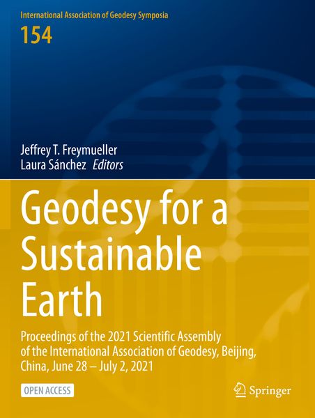
Geodesy for a Sustainable Earth Proceedings of the 2021 Scientific Assembly of the International Association of Geodesy, Beijing, China, June 28 – July 2, 2021

39,99 €

inkl. gesetzl. MwSt., Versandkostenfrei


Beschreibung

Produktdetails

Einband

Taschenbuch

Erscheinungsdatum

14.07.2023

Abbildungen

XII, 441 p. 265 illus., 251 illus. in color.

Herausgeber

Jeffrey T. Freymueller + weitere

Verlag

Springer

Seitenzahl

441

Maße (L/B/H)

27,9/21/2,5 cm

Gewicht

1103 g

Auflage

1st ed. 2023

Sprache

Englisch

ISBN

978-3-031-29509-6

Beschreibung

Produktdetails

Einband

Taschenbuch

Erscheinungsdatum

14.07.2023

Abbildungen

XII, 441 p. 265 illus., 251 illus. in color.

Herausgeber

Verlag

Springer

Seitenzahl

441

Maße (L/B/H)

27,9/21/2,5 cm

Gewicht

1103 g

Auflage

1st ed. 2023

Sprache

Englisch

ISBN

978-3-031-29509-6

Herstelleradresse

Springer-Verlag KG
Sachsenplatz 4-6
1201 Wien
AT

Email: ProductSafety@springernature.com

Noch keine Bewertungen vorhanden

Verfassen Sie die erste Bewertung zu diesem Artikel

Helfen Sie anderen Kundinnen und Kunden durch Ihre Meinung.

Kundinnen und Kunden meinen

Bewertungen (0)

  • Produktbild: Geodesy for a Sustainable Earth
  • Produktbild: Geodesy for a Sustainable Earth
  • Geometric Reference Frames.- Combined IVS Contribution to the ITRF2020.- An Experimental Combination of IGS repro3 Campaign’s Orbit Products Using a Variance Component Estimation Strategy.- The Correlations of the Helmert Transformation Parameters as an Additional Auxiliary Diagnostic Tool for Terrestrial Reference Frames Quality Assessment.- Shimosato Co-Location of the SLR and GNSS Stations.- Local Ties at SLR Station Riga.- Datum Problem Handling in Local Tie Surveys at Wettzell and Metsähovi.- Close Range Photogrammetry for High-Precision Reference Point Determination: A Proof of Concept at Satellite Observing System Wettzell.- Frame Accuracy of Combined EPN Weekly Coordinate Solutions.- The Atlantic Network of Geodynamic and Space Stations (RAEGE): A Spanish-Portuguese Infrastructure of Geodetic Stations.- ITRF Densification in Cyprus.- Geodetic Analyses at the National Geographic Institute of Spain.- Large-Scale Dimensional Metrology for Geodesy - First Results from the European GeoMetre Project.- Bureau of Products and Standards: Description and Promotion of Geodetic Products.- Physical Height Systems.- Can an Earth Gravitational Model Augmented by a Topographic Gravity Field Model Realize the International Height Reference System Accurately?.- Assessing Molodensky’s Heights: A Rebuttal.- On the Accuracy of Geoid Heights Derived from Discrete GNSS/Levelling Data Using Kriging Interpolation.- Gravimetric Geoid Modeling by Stokes and Second Helmert’s Condensation Method in Yogyakarta, Indonesia.- A Geodetic Determination of the Gravitational Potential Difference Toward a 100-km-scale Clock Frequency Comparison in a Plate Subduction Zone.- Validation of the Hellenic Gravity Network in the Frame of the ModernGravNet Project.- Global Gravity Field Modeling.- Combined Gravity Solution from SLR and GRACE/GRACE-FO.- Contribution of LARES SLR Data to Co-estimated Earth Geopotential Coefficients.- Determination and Combination of Monthly Gravity Field Time Series from Kinematic Orbits of GRACE, GRACE-FO and Swarm.- Topographic Gravity Field Modelling for Improving High-Resolution Global Gravity Field Models.- The Benefit of Accelerometers Based on Cold Atom Interferometry for Future Satellite Gravity Missions.- Kalman-Filter Based Hybridization of Classic and Cold Atom Interferometry Accelerometers for Future Satellite Gravity Missions.- Gravimetry by Nanoscale Parametric Amplifiers Driven by Radiation-Induced Dispersion Force Modulation.- Earth Rotation.- On the Improvement of Combined EOP Series by Adding 24-hour VLBI Sessions to VLBI Intensives and GNSS Data.- Investigating the Relationship Between Length of Day and El-Niño Using Wavelet Coherence Method.- Estimation of Earth Rotation Parameter UT1 from Lunar Laser Ranging Observations.- Surface Deformation Monitoring.- Determination of a GNSS-Based Velocity Field of the African Continent.- Vertical Land Motion at Tide Gauges Observed by GNSS: A New GFZ-TIGA Solution.- CyCLOPS: A National Integrated GNSS/InSAR Strategic Research Infrastructure for Monitoring Geohazards and Forming the Next Generation Datum of the Republic of Cyprus.- GNSS Positioning.- Dilution of Precision (DOP) Factors for Evaluating Observations to Galileo Satellites with VLBI.- On the Limits of State-of-the-Art GNSS Receivers in Frequency Transfer.- On the Effect of Antenna Calibration Errors on Geodetic Estimates: Investigation on Zero and Double Difference Approaches.- Estimation and Calibration of Codephase Center Correction Using the Empirical Mode Decomposition.- On the Potential of Image Similarity Metrics for Comparing Phase Center Corrections.- Multipath Characterization Using Ray-Tracing in Urban Trenches.- Bounding the Residual Tropospheric Error by Interval Analysis.- Precise Orbit Determination of CubeSats Using Proposed Observations Weighting Model.- Geodetic Atmospheric and Remote Sensing.- Optimal TEC Forecast Models Based on Machine Learning and Time Series Analysis Techniques – A Preliminary Study on the Ring of Fire.- Sensitivity of Shipborne GNSS Troposphere Retrieval to Processing Parameters.- Application of the Total Variation Method in Near Real-Time GNSS Tropospheric Tomography.- Comparison of the Effective Isotropic Radiated Power Parameter in CYGNSS v2.1 and v3.0 Level 1 Data and Its Impact on Soil Moisture Estimation.- Cross-Polarization Correction for Soil Moisture Retrieval Using GNSS SNR Data.