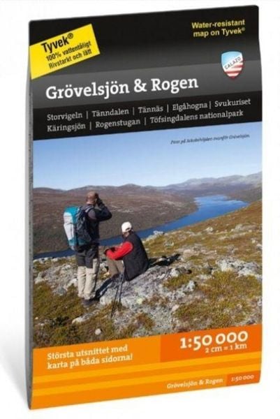
Grovelsjon & Rogen 1:50000
-
- Englisch ausgewählt
19,99 €
inkl. gesetzl. MwSt.,
- Kostenlose Lieferung ab 30 € Einkaufswert
- Versandkostenfrei für Bonuscard-Kund*innen
Beschreibung
Produktdetails
Einband
Karte
Erscheinungsdatum
01.07.2023
Verlag
Calazo ForlagSeitenzahl
2
Maße (L/B/H)
21,5/12,9/0,9 cm
Gewicht
52 g
Sprache
Englisch
EAN
9789186773328
This is a cross-border map of the entire area between Grovelsjon in the south and Tanndalen in the north. The map covers the popular mountain area around Rogen and two national parks; Femundsmarka in Norway and Tofsingdalen in Sweden. The map has a greater wealth of detail than other maps that are based on the mountain information at a scale of 1:100,000, which may be needed if you are going fishing, paddling or ice skating in the multitude of small lakes in the area. We have come to the conclusion that the best material for a map is Tyvek®. It is made of a synthetic fiber that makes the map completely insensitive to water and very tear-resistant. A Tyvek map will not tear in the folds or lose color when you use it.
Noch keine Bewertungen vorhanden
Verfassen Sie die erste Bewertung zu diesem Artikel
Helfen Sie anderen Kundinnen und Kunden durch Ihre Meinung.
Kurze Frage zu unserer Seite
Vielen Dank für Ihr Feedback
Wir nutzen Ihr Feedback, um unsere Produktseiten zu verbessern. Bitte haben Sie Verständnis, dass wir Ihnen keine Rückmeldung geben können. Falls Sie Kontakt mit uns aufnehmen möchten, können Sie sich aber gerne an unseren Kund*innenservice wenden.
zum Kundenservice