
KI-Beratung Beta

Gutscheinbedingungen

**Gültig bis 18.11.2026 auf englischsprachige Klassiker (klassiker-32728) online auf thalia.at und in der Thalia App. Einzelne Artikel können ausgeschlossen sein. Ausgenommen sind preisgebundene Artikel & eBooks. Pro Einkauf einmal einlösbar. Click & Collect nur bei Onlinevorabzahlung möglich. Keine Barauszahlung. Nicht kombinierbar mit anderen Aktionen und Gutscheinen. Gutschein wird auf max. 500€ Bestellwert angerechnet. Nicht gültig für Geschenkkarten, Versandkosten und Services.

  • Produktbild: International Symposium on Earth and Environmental Sciences for Future Generations
  • Produktbild: International Symposium on Earth and Environmental Sciences for Future Generations
Band 147 - 10%

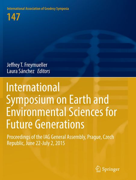
International Symposium on Earth and Environmental Sciences for Future Generations Proceedings of the IAG General Assembly, Prague, Czech Republic, June 22- July 2, 2015

10% sparen

196,99 € UVP 219,99 €

inkl. gesetzl. MwSt., Versandkostenfrei


Beschreibung

This book series is composed of peer-reviewed proceedings of selected symposia organized by the International Association of Geodesy. It deals primarily with topics related to Geodesy Earth Sciences : terrestrial reference frame, Earth gravity field, Geodynamics and Earth rotation, Positioning and engineering...

Beschreibung

This book series is composed of peer-reviewed proceedings of selected symposia organized by the International Association of Geodesy. It deals primarily with topics related to Geodesy Earth Sciences : terrestrial reference frame, Earth gravity field, Geodynamics and Earth rotation, Positioning and engineering applications.

Produktdetails

Einband

Taschenbuch

Erscheinungsdatum

23.05.2018

Abbildungen

X, 137 illus. in color., farbige Illustrationen

Herausgeber Jeffrey T. Freymueller + weitere

Produktdetails

Einband

Taschenbuch

Erscheinungsdatum

23.05.2018

Abbildungen

X, 137 illus. in color., farbige Illustrationen

Herausgeber
Verlag Springer
Seitenzahl

364

Maße (L/B/H)

27,9/21/2,1 cm

Gewicht

951 g

Auflage

Softcover reprint of the original 1st ed. 2018

Sprache

Englisch

ISBN

978-3-319-88724-1

Herstelleradresse

Springer International Publishing AG
Gewerbestr. 11
6330 Cham
Schweiz
Url: www.springer.com

Noch keine Bewertungen vorhanden

Verfassen Sie die erste Bewertung zu diesem Artikel

Helfen Sie anderen Kundinnen und Kunden durch Ihre Meinung.

Kundinnen und Kunden meinen

Bewertungen (0)

  • Produktbild: International Symposium on Earth and Environmental Sciences for Future Generations
  • Produktbild: International Symposium on Earth and Environmental Sciences for Future Generations
  • Part 1 - Geodetic Reference Systems and Frames.- Simulation of VLBI observations to determine a global TRF for GGOS.- The Assessment of the Temporal Evolution of Space Geodetic Terrestrial Reference Frames.- Analysis strategies for the densification of the ICRF with VLBA Calibrator Survey sources.- Towards the Definition and Realization of a Global Absolute Gravity Reference System.- Part 2 - Static Gravity Field Observations and Modelling.- The linearized fixed gravimetric boundary value problem and its solution in spheroidal approximation.- On the convergence of the h-p finite element method for solving boundary value problems in physical geodesy.- Domain Transformation and the Iteration Solution of the Linear Gravimetric Boundary Value Problem.- A New Argentinean Gravimetric Geoid Model – GEOIDEAR.- Exploitation of marine gravity measurements in the validation of global gravity field models.- Traceability of the Hannover FG5X-220 to the SI units.- Evaluation of Robert Sterneck's historical gravity pendulum measurements in the Czech territory.- Part 3 - Detection and Modelling of Gravity Field Variations.- Ground-satellite comparisons of time variable gravity: results, issues and on-going projects for the null test in arid regions.- Impact of groundtrack pattern of double pair missions on the gravity recovery quality - Lessons from the ESA SC4MGV project.- A posterior de-aliasing of ocean tide error in future double-pair satellite gravity missions.- A method of airborne gravimetry by combining strapdown inertial and new satellite observations via dynamic networks.- Hybrid gravimetry as a tool to monitor surface and underground mass changes.- Tidal spectroscopy from a long record of superconducting gravimeters in Strasbourg (France).- Investigations of a suspected jump in Swedish repeated absolute gravity time series.- Part 4 - Earth Rotation and Geodynamics.- Detailed analysis of diurnal tides and associated space nutation in the search of the Free Inner Core Nutation resonance.- Chandler wobble and frequency dependency of the ratio between gravity variation and vertical displacement for a simple Earth model with Maxwell or Burgers rheologies.- Detection of the atmospheric S 1 tide in VLBI polar motion time series.- Free Core Nutation parameters from hydrostatic long-base tiltmeter records in Sainte Croix aux Mines (France).- Numerical Issues in Space-Geodetic Data Analysis and their Impact on Earth Orientation Parameter.- A non-tidal atmospheric loading model: On its quality and impacts on orbit determination and C20 from SLR.- Effects of meteorological input data on the VLBI station coordinates, network scale, and EOP.- History of monitoring Earth orientation, and re-analyses of old data.- Part 5 - Advances in GNSS Technologies, Data Processing, and Applications.- Multi-GNSS PPP-RTK: mixed-receiver network and user scenarios.- A New Method for Real-Time PPP Correction Updates.- Towards reliable and precise BeiDou positioning with stochastic modelling.- PPP carrier phase residual stacking for turbulence investigations.- On Removing Discrepancies Between Local Ties and GPS-Based Coordinates.- Receiver Antenna Phase Center Models and Their Impact on Geodetic Parameters.- Singular spectrum analysis for modeling geodetic time series.- Impact of Limited Satellite Visibility on Estimates of Vertical Land Movements.- Noise filtering augmentation of the Helmert transformation for the mapping of GNSS derived position time series to a target frame.- Part 6 - Geodetic Modelling of Atmospheric Variables.- Assessing GPS + Galileo Precise Point Positioning Capability for Integrated Water Vapor Estimation.- Atmospheric perceptible water in Somma-Vesuvius area during extreme weather events from ground-based GPS measurements.- Water vapor radiometer data in very long baseline interferometry data analysis.- Part 7 - Geodetic Monitoring of Surface Deformations.- Land subsidence detected by persistent scatterer interferometry using ALOS/PALSAR data from the Nakagawa lowland in the central Kanto Plain, Japan.- A new velocity field of Greece based on seven years (2008-2014) continuously operating GPS station data.- SPINA Region (South of Iberian Peninsula, North of Africa) GNSS geodynamic model.- Continuous Kinematic GPS Monitoring of a Glacier Lake Outburst Flood.- Water in Central Asia - Reservoir Monitoring with Radar Altimetry along the Naryn and Syr Darya Rivers.- Erratum to: AMethod of Airborne Gravimetry by Combining Strapdown Inertial and New Satellite Observations via Dynamic Networks.