Gutscheinbedingungen

**Gültig nur für Bestellungen an die Wunsch-Poststation bis 10.06.2026 auf Spielzeug, Schreibwaren, Filme, Geschenke & Trends, Musik, tolino eReader & Zubehör, Hörbücher und Hörbuch-Downloads (außer Abo), nicht preisgebundene Bücher und Kalender online auf thalia.at und in der Thalia App. Einzelne Artikel können ausgeschlossen sein. Aufgrund der Buchpreisbindung sind deutschsprachige Bücher und eBooks ausgenommen. Zusätzlich ausgenommen sind preisgebundene Artikel, Abos & Flatrates, eBooks, Games, Geschenkkarten/-boxen, Shelfies, Software, Zeitschriften sowie einzelne Artikel von tonies®. Pro Einkauf einmal einlösbar. Kein Click & Collect möglich. Keine Barauszahlung. Nicht kombinierbar mit anderen Aktionen und Gutscheinen. Gutschein wird auf max. 500€ Bestellwert angerechnet. Nicht gültig für Versandkosten und Services.

Produktbild: Maps

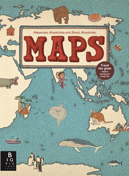
Maps Travel the globe without leaving your living room

33,99 €

inkl. gesetzl. MwSt., Versandkostenfrei


Beschreibung

Produktdetails

Einband

Gebundene Ausgabe

Altersempfehlung

ab 10 Jahr(e)

Erscheinungsdatum

01.10.2013

Verlag

Templar Publishing

Seitenzahl

112

Maße (L/B/H)

37,8/27,6/2 cm

Gewicht

1240 g

Sprache

Englisch

ISBN

978-1-84877-301-1

Beschreibung

Rezension

The 52 illustrated maps in this book invite the reader on a journey of exploration around the world. Opening with an original style of contents page, consisting of a world map with countries labelled with the pages where information can be found, the atlas is divided into eight sections, looking at countries within each continent plus the Arctic and Antarctica. Not every country in, fro example Africa or South America, is included, but, those that are, give a flavour of the variety to be found there. I like the way that the European section travels southwards from Iceland, which means that countries such as Croatia and Romania are given equal space alongside the perhaps more familiar France and Spain. There is a dearth of information about some of these places (publishers tend to concentrate on what they see as the 'main' countries), particularly for young children. This book would have been very welcome at my school last term when Iceland was included in the Year 1 topic of Around the World!

Each large, intricately detailed double page spread features fascinating facts, places of interest, wildlife and important people, all of which could provide a springboard for discussion and further research. This is an innovative approach to geography which will keep young and not so young, discoverers coming back again and again to pore over the quirky, delightful drawings. A must for the primary library or classroom; every page provides a good display opportunity!

Jayne Gould The School Librarian Journal

Produktdetails

Einband

Gebundene Ausgabe

Altersempfehlung

ab 10 Jahr(e)

Erscheinungsdatum

01.10.2013

Verlag

Templar Publishing

Seitenzahl

112

Maße (L/B/H)

37,8/27,6/2 cm

Gewicht

1240 g

Sprache

Englisch

ISBN

978-1-84877-301-1

Herstelleradresse

Libri GmbH
Europaallee 1
36244 Bad Hersfeld
DE

Email: gpsr@libri.de

Kundinnen und Kunden meinen

0 Bewertungen

Informationen zu Bewertungen

Zur Abgabe einer Bewertung ist eine Anmeldung im Konto notwendig. Die Authentizität der Bewertungen wird von uns nicht überprüft. Wir behalten uns vor, Bewertungstexte, die unseren Richtlinien widersprechen, entsprechend zu kürzen oder zu löschen.

Die Bewertungen sind nach Format, Anzahl Sterne und Datum sortiert.

Verfassen Sie die erste Bewertung zu diesem Artikel

Helfen Sie anderen Kund*innen durch Ihre Meinung

Kundinnen und Kunden meinen

0 Bewertungen filtern

Weitere Artikel finden Sie in

  • Produktbild: Maps