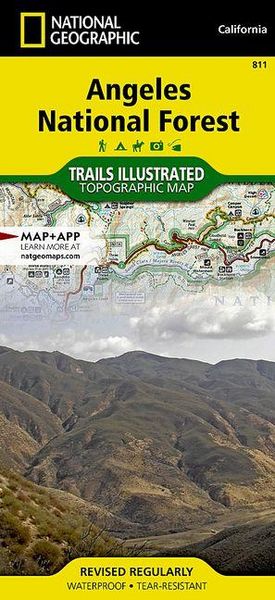
Angeles National Forest Map
-
- Englisch ausgewählt
15,99 €
inkl. gesetzl. MwSt.,
- Kostenlose Lieferung ab 30 € Einkaufswert
- Versandkostenfrei für Bonuscard-Kund*innen
Beschreibung
Produktdetails
Einband
Karte
Erscheinungsdatum
01.01.2020
Verlag
National geographicSeitenzahl
2
Maße (L/B/H)
23,3/10,8/0,7 cm
Gewicht
91 g
Auflage
2020th edition
Sprache
Englisch
ISBN
978-1-56695-577-5
- Waterproof - Tear-Resistant - Topographic Map
National Geographic's Trails Illustrated map of Angeles National Forest provides both unmatched detail and valuable information for outdoor enthusiasts enjoying this diverse recreational area just north of Los Angeles. Expertly researched and created in partnership with the U.S. Forest Service, California State Parks and others, this map features key points of interest in the forest including Magic Mountain, Pleasant View Ridge, San Gabriel, Cucamonga and Sheep Mountain Wilderness Areas; San Gabriel Mountains; Pyramid Lake; and Piru Creek Wild and Scenic River.
- Also included are nearby California State Parks: Antelope Valley California Poppy Reserve, Ripley Desert Woodland, Castaic Lake State Recreation Area, Hungry Valley State Vehicular Recreation Area and Placerita Canyon.
- Get off the beaten path and back on again by following the map along precisely mapped trails, labeled with mileage markers and color-coded according to designated use, whether hiking, mountain biking, ATVing or horseback riding.
- Highlighted are the nearly 200 miles of Pacific Crest Trail that wind through the area.
Your navigation will be aided by the map's contour lines, elevations, labeled peaks and canyons, water features, and clear boundaries between national forest, wilderness and private land. Hundreds of recreation features are marked including areas for camping, fishing, swimming, climbing, canoeing, motor boating, skiing and winter recreation.
Every Trails Illustrated map is printed on "Backcountry Tough" waterproof, tear-resistant paper. A full UTM grid is printed on the map to aid with GPS navigation.
Other features found on this map include: Acton, Altadena, Angeles National Forest, Arcadia, Azusa, Big Dalton Reservoir, Big Tujunga Canyon, Big Tujunga Reservoir, Bouquet Reservoir, Burbank, Castaic Lake, Chatsworth Reservoir, Cogswell Reservoir, Devils Gate Reservoir, Duarte, Elizabeth Lake Ranch (historical), Glendale, Glendora, La Crescenta, Lake Hughes, Lake Piru, Littlerock, Los Angeles County, Mint Canyon, Monrovia, Montrose, Morris Reservoir, Mount Baldy, Mount San Antonio, Mount Wilson, Newhall, Palmdale, Pasadena, Pearblossom, Piru, Piru Creek, Pyramid Lake, San Antonio Heights, San Dimas Reservoir, San Fernando, San Fernando Valley, San Gabriel Mountains, San Gabriel Reservoir, Santa Susana, Santa Susana Mountains, Saugus, Sierra Madre, Simi Valley, Soledad Canyon, Upper Van Norman Lake, West Fork San Gabriel River, Wrightwood.
- Map Scale = 1:80,000
- Sheet Size = 25.5" x 37.75"
- Folded Size = 4.25" x 9.25"
Noch keine Bewertungen vorhanden
Verfassen Sie die erste Bewertung zu diesem Artikel
Helfen Sie anderen Kundinnen und Kunden durch Ihre Meinung.
Kurze Frage zu unserer Seite
Vielen Dank für Ihr Feedback
Wir nutzen Ihr Feedback, um unsere Produktseiten zu verbessern. Bitte haben Sie Verständnis, dass wir Ihnen keine Rückmeldung geben können. Falls Sie Kontakt mit uns aufnehmen möchten, können Sie sich aber gerne an unseren Kund*innenservice wenden.
zum Kundenservice