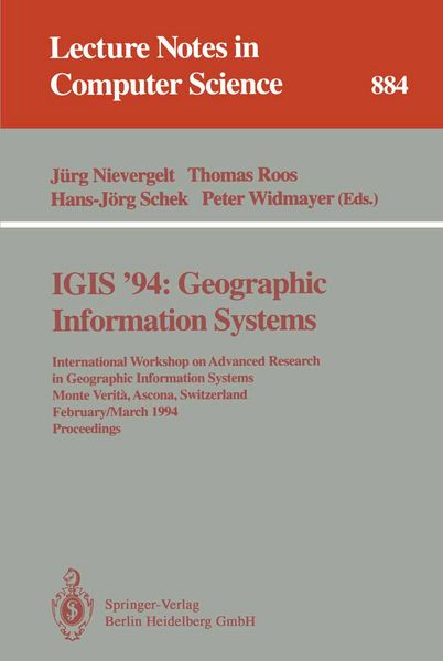
IGIS '94: Geographic Information Systems International Workshop on Advanced Research in Geographic Information Systems, Monte Verita, Ascona, Switzerland, February 28 - March 4, 1994. Proceedings
-
- Englisch ausgewählt
51,99 €
inkl. gesetzl. MwSt.,
Beschreibung
Produktdetails
Einband
Taschenbuch
Erscheinungsdatum
30.11.1994
Abbildungen
IX, 299 p.
Herausgeber
Jürg Nievergelt + weitereVerlag
Springer BerlinSeitenzahl
299
Maße (L/B/H)
23,5/15,5/1,7 cm
Gewicht
470 g
Auflage
1994
Sprache
Englisch
ISBN
978-3-540-58795-8
This volume constitutes the proceedings of the International Workshop on Advanced Research in Geographic Information Systems, IGIS '94, held in Ascona, Switzerland in February/March 1994.
The 28 carefully refereed and revised papers address all current aspects of GIS research and their advanced applications to spatial and environmental data engineering. Among the topics covered are GIS theory, spatial databases, spatial data structures, environmental modelling and control, data modelling, object-orientation, pattern recognition, and optimization. In addition, software and non-commercial as well as commercial GIS are analysed.
Noch keine Bewertungen vorhanden
Verfassen Sie die erste Bewertung zu diesem Artikel
Helfen Sie anderen Kundinnen und Kunden durch Ihre Meinung.
Kurze Frage zu unserer Seite
Vielen Dank für Ihr Feedback
Wir nutzen Ihr Feedback, um unsere Produktseiten zu verbessern. Bitte haben Sie Verständnis, dass wir Ihnen keine Rückmeldung geben können. Falls Sie Kontakt mit uns aufnehmen möchten, können Sie sich aber gerne an unseren Kund*innenservice wenden.
zum Kundenservice